*国連衛星センター(UNOSAT)
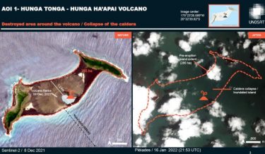
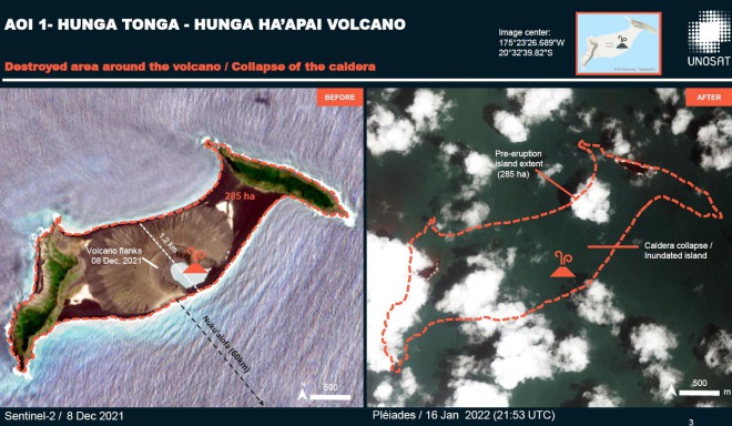
国連衛星センター(UNOSAT)が1月15日に南太平洋のトンガ近海で発生した大噴火の衛星写真を公開しました。
公開された衛星写真には噴火前と噴火後の画像が掲載されており、噴火場所にあった約285ヘクタールの陸地が完全に消失し、島がほぼ丸ごと消えた状態となっています。
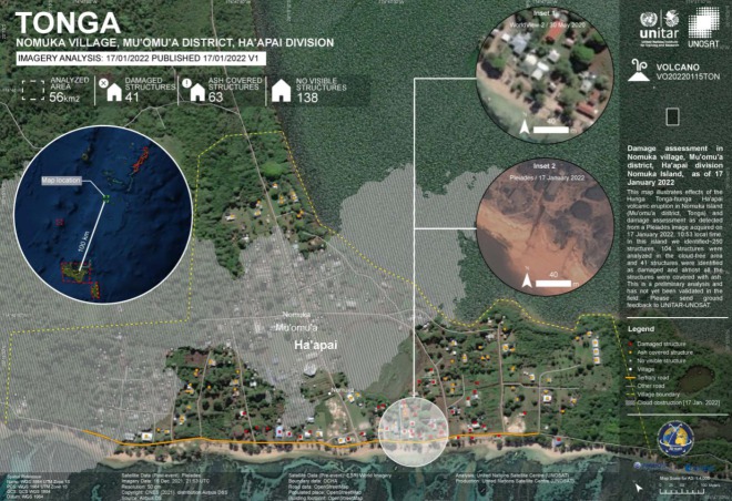
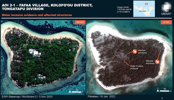
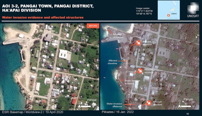
トンガの港町や都市部も火山灰で風景が一変し、宇宙から見ても分かるほどに灰色一色に染まっていました。
凄まじい噴火の威力を示す写真だと言え、トンガが大きな被害を受けていることも感じることが出来ます。
All the analysis results and latest updates on the #Tongaeruption will be available on the live web map
🗺️➡️https://t.co/bC6GOSuIm8@UNOCHA_Pacific @OCHAAsiaPac @TongaMissionUN @DisastersChart #TongaVolcano #TongaTsunami #Tongaeruption #HungaTonga #HungaTongaHungaHaapai— UNOSAT (@UNOSAT) January 17, 2022
This map shows the damages of #Tongaeruption in Nomuka village as of 17 January:
🔹104 structures were analyzed in the cloud-free area, almost all the structures were covered with ash, 41 were identified as damaged
➡️https://t.co/OQxJ8lZZG2#HungaTongaHungaHaapai #TongaVolcano pic.twitter.com/ffAzqRzEkj— UNOSAT (@UNOSAT) January 17, 2022
.@UNOSAT produced a preliminary assessment of the impact from #HungaTongaHungaHaapai volcano: https://t.co/hZ4vheqRwg
See a few extracts from the report, providing before and after comparisons using #Pleiades, #Sentinel2 and WorldView imagery. #TongaVolcano pic.twitter.com/XgzgPFycC3— Disasters Charter (@DisastersChart) January 17, 2022
いいね!しよう
